Ride Characteristics
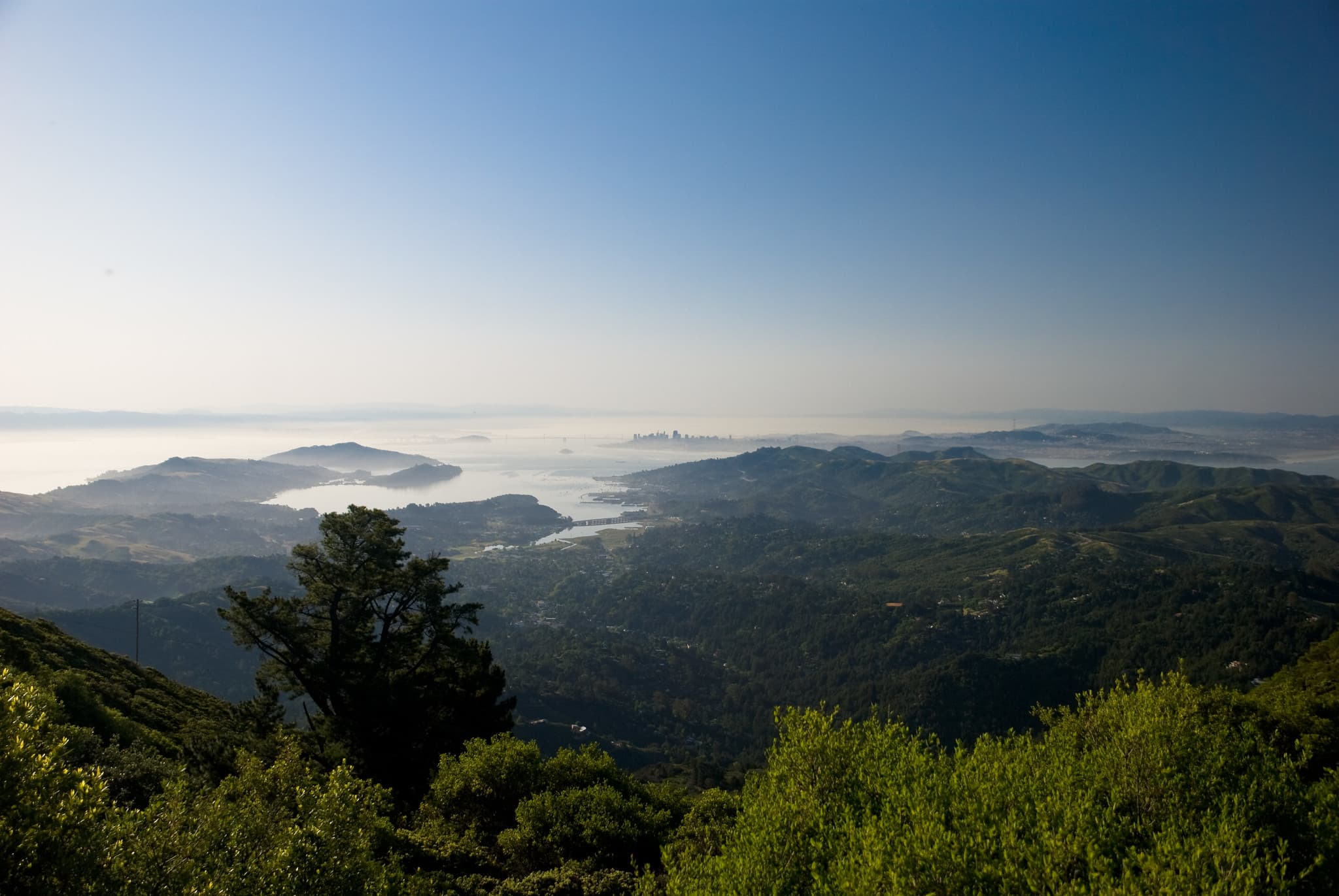
The route winds from Fairfax through Mount Tamalpais State Park, featuring dramatic elevation changes, forest passages, ridge lines, and spectacular panoramic views of San Francisco Bay, the Pacific Ocean, and the surrounding Marin landscape.
Terrain and Challenges
- Total Distance: 38 miles
- Elevation Gain: Significant, with two primary challenging climbs
- Road Surfaces: Varied, from smooth ridge roads to forest paths with occasional rough patches
- Difficulty: Advanced, suitable for experienced cyclists
Mount Tamalpais Key Highlights
Climbing Segments
- Initial Climb: Longest and most challenging, leaving Fairfax
- Alpine Lake Climb: Second major ascent, approximately 2 miles of serpentine climbing
- West Ridgecrest Boulevard: Scenic ridge riding with rolling terrain
Scenic Viewpoints
- East Peak Summit: Panoramic views of San Francisco, Bay Area, and Pacific Ocean
- West Ridgecrest Boulevard: Spectacular ridge-line vistas
- Seven Sisters: Series of challenging rollers with expansive landscape views
Route Sections
Fairfax to Alpine Dam
- Dense, shadowy forest environments
- Roller-coaster terrain
- Occasional challenging road surfaces
Alpine Dam to East Peak
- Climbing through woodland landscapes
- Transition from forest to open ridge lines
Descent from East Peak
- 11-mile descent with smooth, banked curves
- Minimal traffic (especially before 3 PM)
- Considered one of the west coast's premier cycling descents
Practical Considerations
Weather Variability
- Extreme microclimate changes possible
- Temperature differences of up to 20 degrees within short distances
- Recommend flexible clothing layers
Traffic
- Heaviest traffic on mountain's south side
Local Attractions
- Fairfax: Coffee stop at Barefoot Cafe
- Marin Museum of Cycling
- Mountain Bike Hall of Fame
For cyclists seeking the quintessential California riding experience, this Mount Tamalpais route represents a breathtaking journey through some of the most spectacular landscapes in the United States.