5 Best Bike Trails in California
California's unique climate makes it perfect for cycling year-round. This sunny state is home to many fantastic bike routes.
Below are five of California's best bike trails, featuring stunning mountain views, car-free paths, and interesting attractions along the way. The list includes both Northern and Southern California routes.
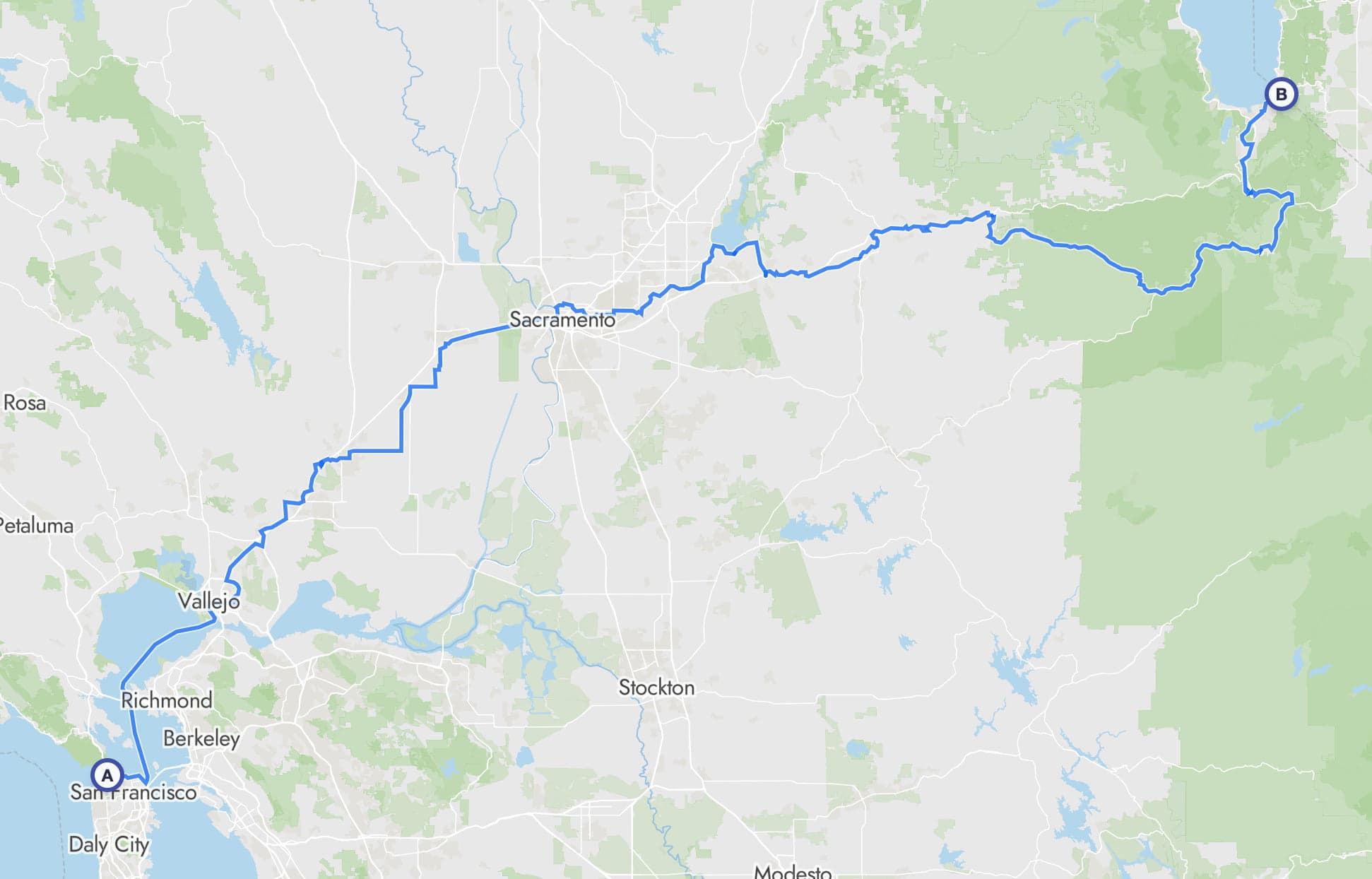
1. U.S. Bicycle Route 50
We begin our list with the longest bike route among our selections, as we believe that when it comes to enjoying California by bike - more time on the road means a better experience.
U.S. Bicycle Route 50 (California Section) offers a fun journey from San Francisco's iconic Golden Gate to the serene Lake Tahoe. The route includes a ferry ride across the bay and gradually climbs from the Pacific Ocean to the mountainous landscapes of the Sierra Nevada.
It's a 5-8 day journey and is predominantly on paved surfaces, making it suitable for road bikes, gravel bikes, or trekking bikes. However, we feel that the optimal bike for this route is a road bike or a gravel bike.
 Lagoon Valley Park. Photo by AlessandraRC
Route
Stats
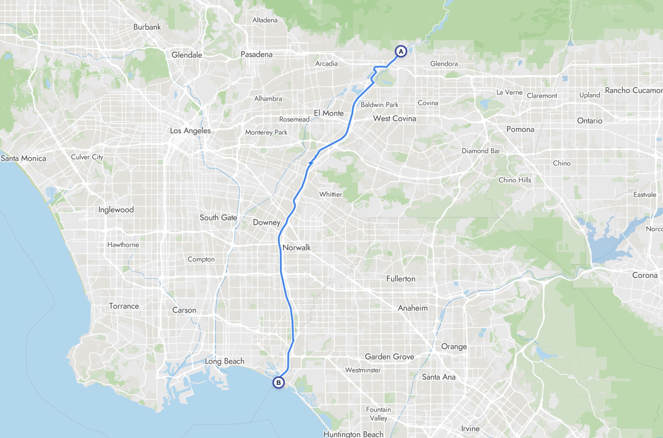
2. San Gabriel River Trail
Another excellent trail that runs almost entirely on well-maintained paved bike paths.
The trail follows the channelized San Gabriel River, taking you through a diverse mix of mountain-adjacent landscapes and industrial areas before reaching the coast.
Start in the town of Azusa at the base of the San Gabriel Mountains and enjoy a gradual descent all the way to the Pacific Ocean at Seal Beach. Along the way, consider stopping at El Dorado East Regional Park. You'll find a beautiful lake and good rest areas there.
 San Gabriel River Trail. Photo by The Greater Southwestern Exploration Company
Route
Stats
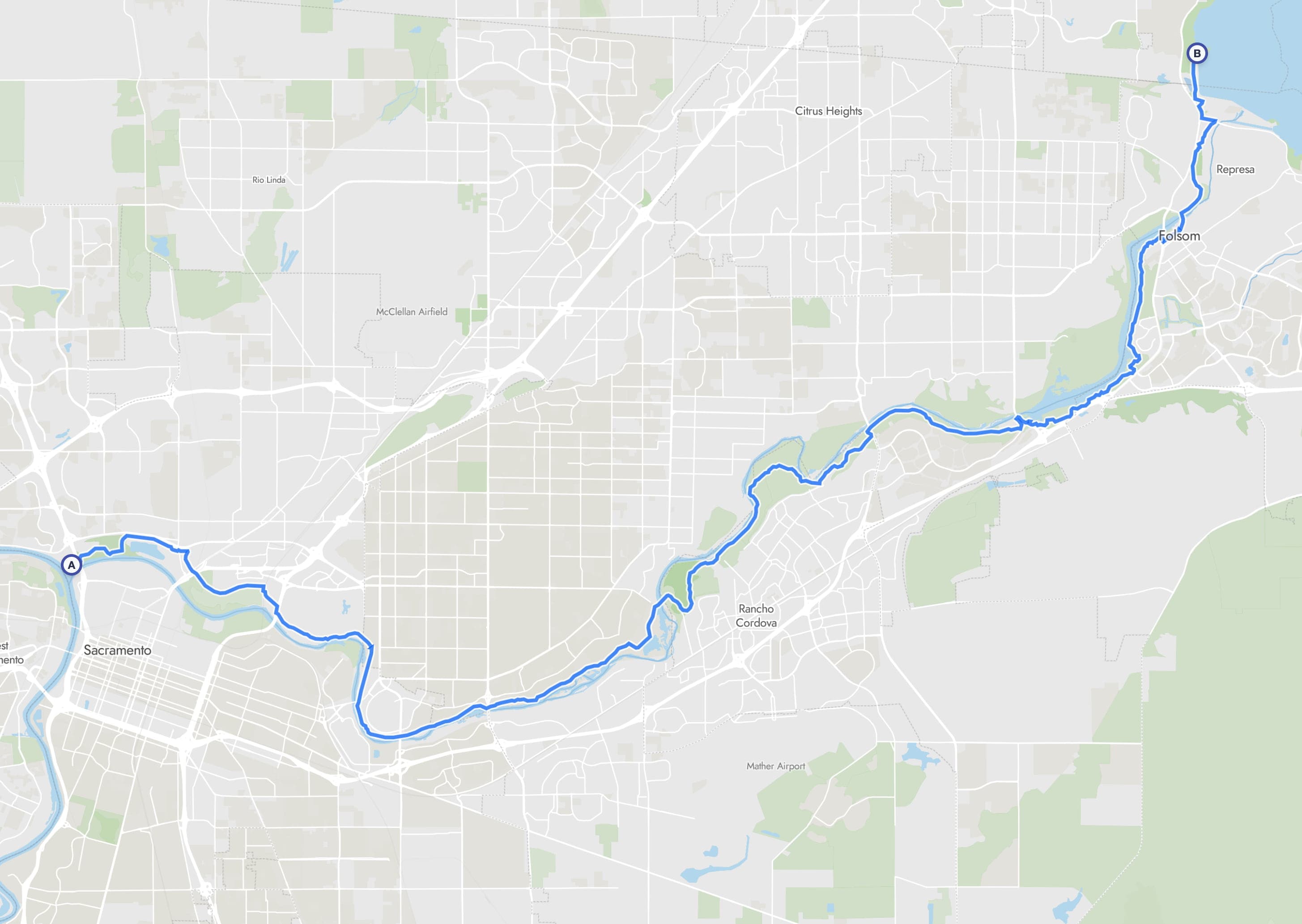
3. American River Trail
One of the longest paved bike paths in the United States, the American River Trail connects downtown Sacramento to Folsom Lake via 32 miles of high-quality paved pathway.
The route begins at Discovery Park near the confluence of the Sacramento and American Rivers, winding eastward through the American River Parkway to finish at Beal's Point on Folsom Lake. And if you feel like taking a quick dip, you can rent a kayak or a canoe at Lake Natoma Paddle Rentals along the way.
Since the trail is almost entirely paved, it's suitable for every type of bike.
Perfect for a day trip or a weekend getaway.
 Lake Natoma, Folsom, California. Photo by Michael Hicks
Route
Stats
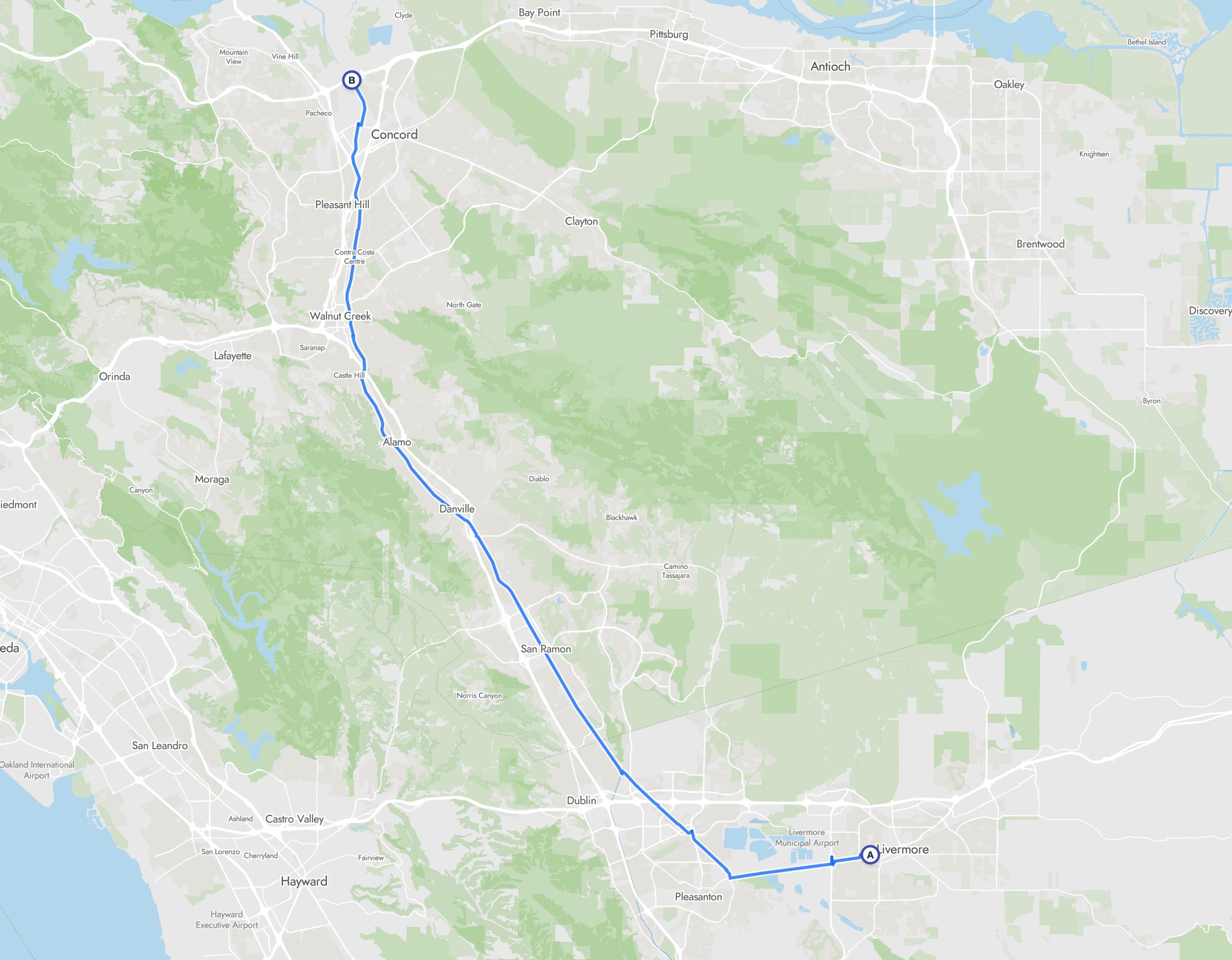
4. Iron Horse Trail
32-mile paved route which follows the historic Southern Pacific Railroad. The trail connects nine East Bay communities from Concord to Pleasanton with minimal elevation changes. Additionally, this part of the Bay Area is known for very low crime rates and is very safe to ride. Perfect for cyclists of all abilities.
The trail is connected to Pleasant Hill and Dublin/Pleasanton BART stations making it super accessible.
 Iron Horse Trail
Route
Stats
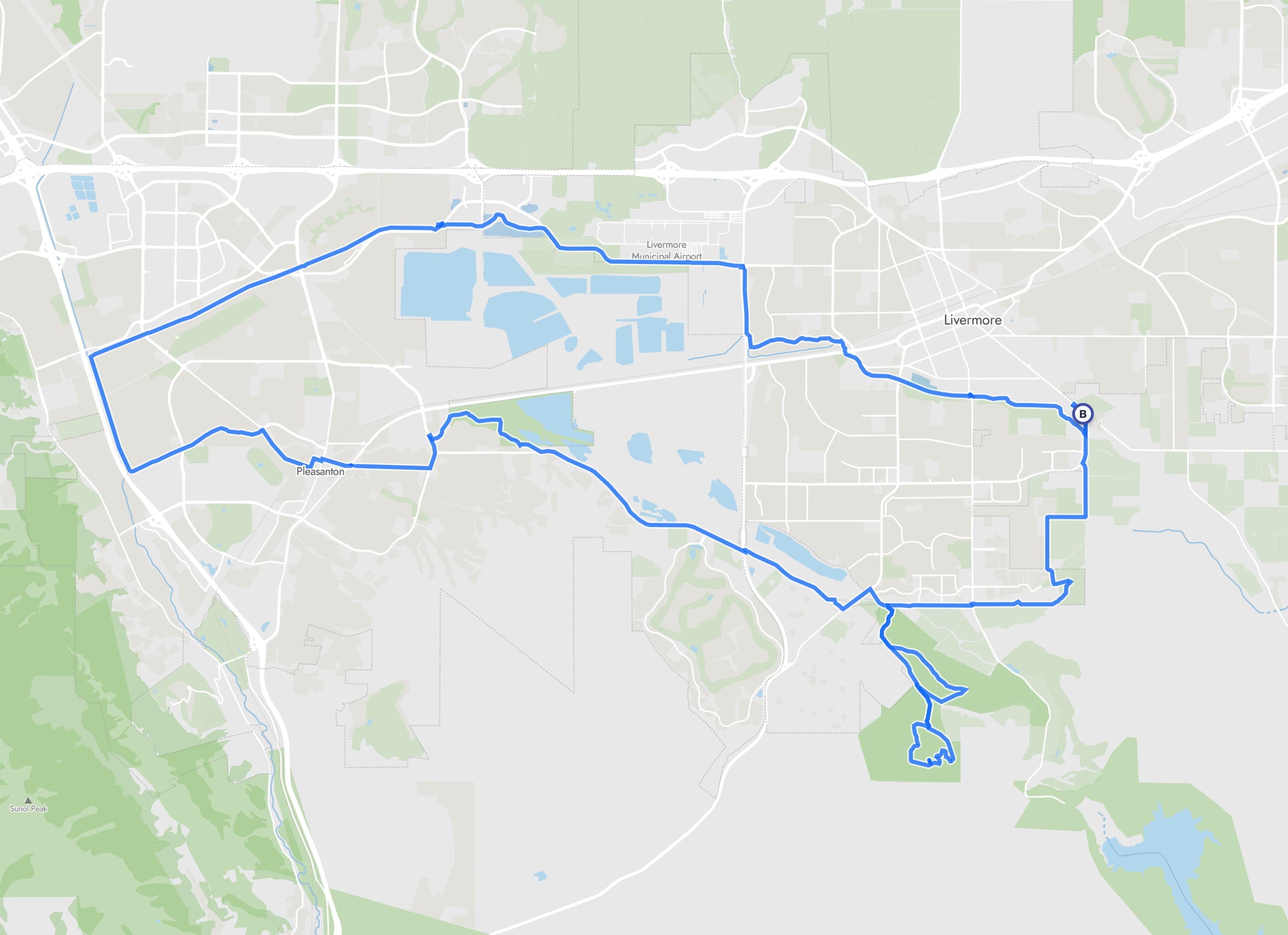
5. Livermore Loop
29-mile loop that starts and ends next to Robertson Park in Livermore, California. The trail is approximately 50% gravel/unpaved routes and 50% paved routes on a cycleway mostly separated from motorized traffic. Some sections require cyclists to share the road with vehicles.
The route offers predominantly urban scenery with occasional "outdoor" sections
A gravel bike is recommended due to the numerous unpaved sections.
Route
Stats
Other Bike Routes in California
Explore more bike trails in California and other states on our interactive bike route map.