Trail Characteristics
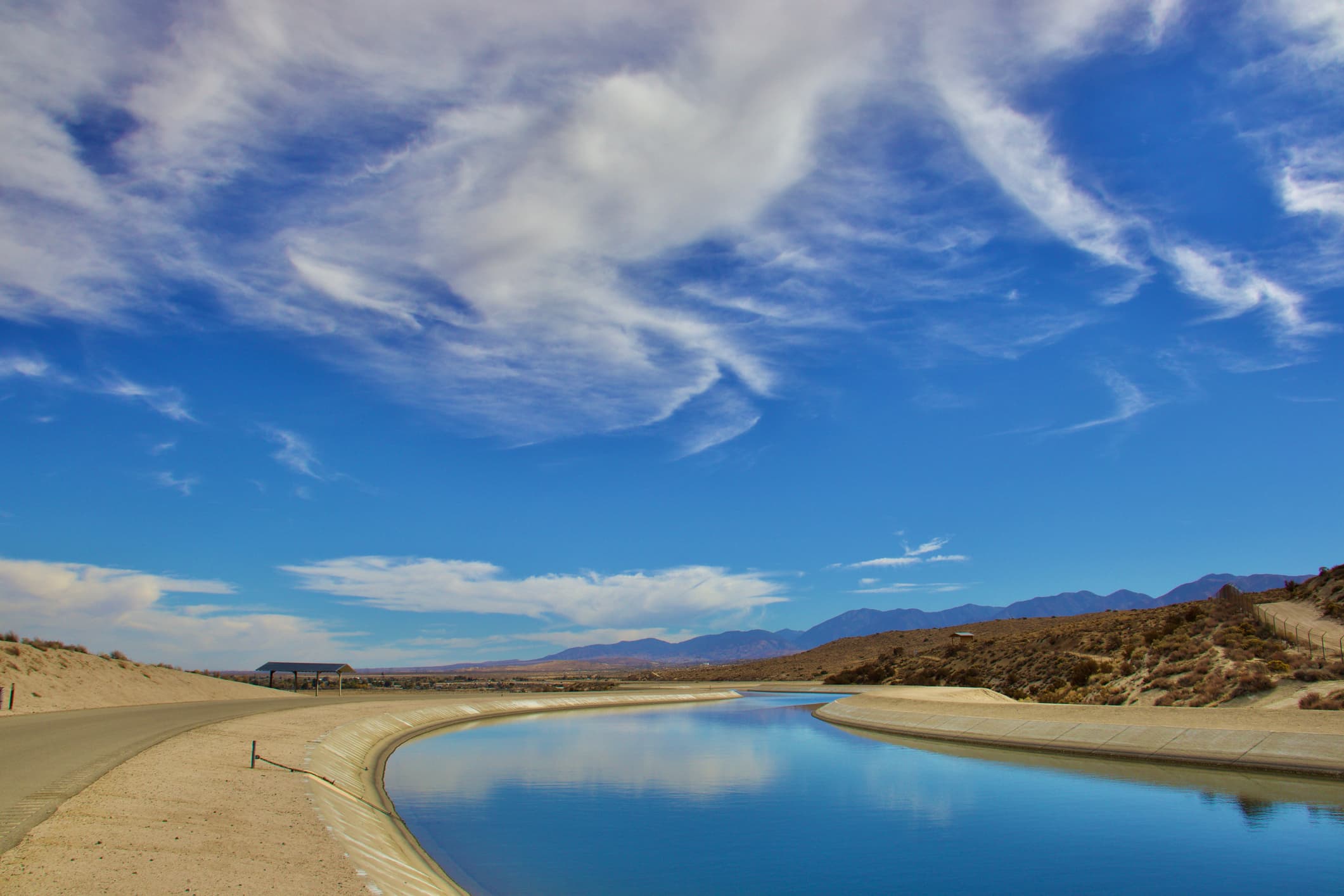
The route begins at Bethany Reservoir near Tracy and concludes at O'Neil Forbay, located at the base of the San Luis Reservoir. Cyclists traverse a concrete canal system that is 40 feet wide at the base and averages 30 feet in depth, offering a distinctive riding experience through California's agricultural landscape.
Road Surface and Infrastructure
- Maintenance roads provide the cycling path
- Bicycle gate crossings at road intersections require walking the bike
- Gate crossings are more frequent in the first 20 miles, becoming sparse in the final 40 miles
- Concrete canal pathway offers a unique and consistent riding surface
Difficulty and Accessibility
The trail is moderately challenging, suitable for cyclists comfortable with long, exposed routes. Key considerations include:
- Total accessible cycling distance of approximately 65 miles
- Limited services and amenities along the route
- Minimal shade and potential for hot, windy conditions
Facilities and Services
Minimal infrastructure characterizes this route:
- Single picnic area with shade overhang and table
- Very limited food and drink options
- Only one area near a road with potential for convenience store access
Destination Highlights
O'Neil Forbay
The trail's endpoint offers additional recreational opportunities:
- Boating
- Fishing
- Limited swimming
- San Luis Creek Campground
Preparation and Recommendations
Essential Gear
- Ample water supply
- Sun protection
- Shade cover
- Bicycle repair kit
- Navigation tools
Logistical Considerations
- One-way trip recommended
- Limited vehicle support options
- Check current trail conditions before departure
For cyclists seeking a unique blend of infrastructure exploration and endurance cycling, the California Aqueduct Bike Trail offers an interesting journey through Northern California engineered landscape.